
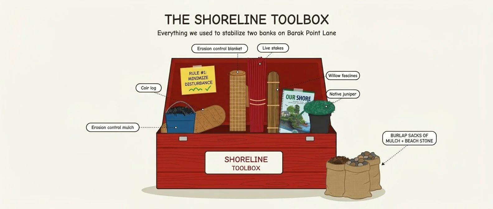
See the OUR SHORE Reference Guide for a more exhaustive toolbox of methods that use natural materials for stabilization
Where the land meets the lake
Stand at the water's edge on Barak Point Lane in Burnham Maine and you can read the shoreline's history in the bank itself. Exposed roots. Soil slumping toward the waterline. Bare patches where every rainstorm and wind-driven wave carries a little more of the yard into Unity Pond.
It doesn't look dramatic on any single day. That's the problem. Shoreline erosion is slow and steady, and the soil it moves doesn't just disappear. It carries phosphorus into the lake, and phosphorus feeds the algae blooms that cloud the water, use up oxygen, and degrade habitat for fish and wildlife. Unity Pond (also known as Lake Winnecook) has struggled with exactly this kind of nutrient loading, which is why it is the focus of a multi-year watershed restoration effort.
This season, as part of the Unity Pond Watershed Restoration Project, Section 319 Phase III, two neighboring properties on Barak Point Lane became something of an outdoor classroom for doing it right. Instead of hardening the shore with only riprap or a wall, the project team turned to nature-based solutions: materials and plants that work with the shoreline rather than against it, and that get stronger as they grow in.
A crew of many hands
Shoreline work is physical, detailed, and best done with a lot of people. Two classes of students from the Ecology Learning Center, led by teacher Kate Coseo, spent time on the bank hauling materials, driving stakes, and planting, learning why each piece goes where it does. They worked alongside staff from state agencies, the University of Maine, the local conservation district, and the lake association. Each property had its own quirks, so the design was modified before work began, with approval from Valerie Watson of Maine DEP, and the crew made slight adjustments in the field on work day.
A toolbox built from nature
What made these two sites stand out was the sheer variety of techniques. Rather than one fix applied everywhere, the team matched each stretch of bank to the approach that suited it, following best practices from the OUR SHORE guide. Here's the toolbox (click the image for a more detailed description):
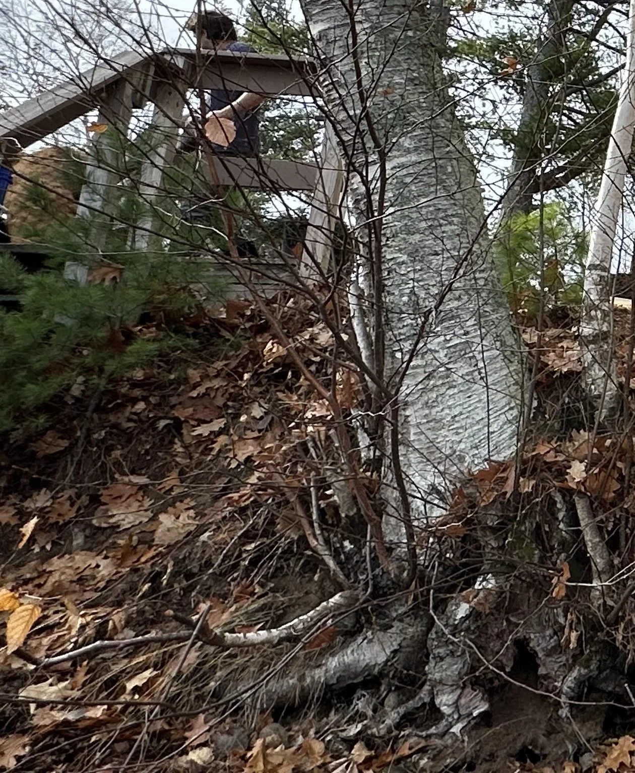
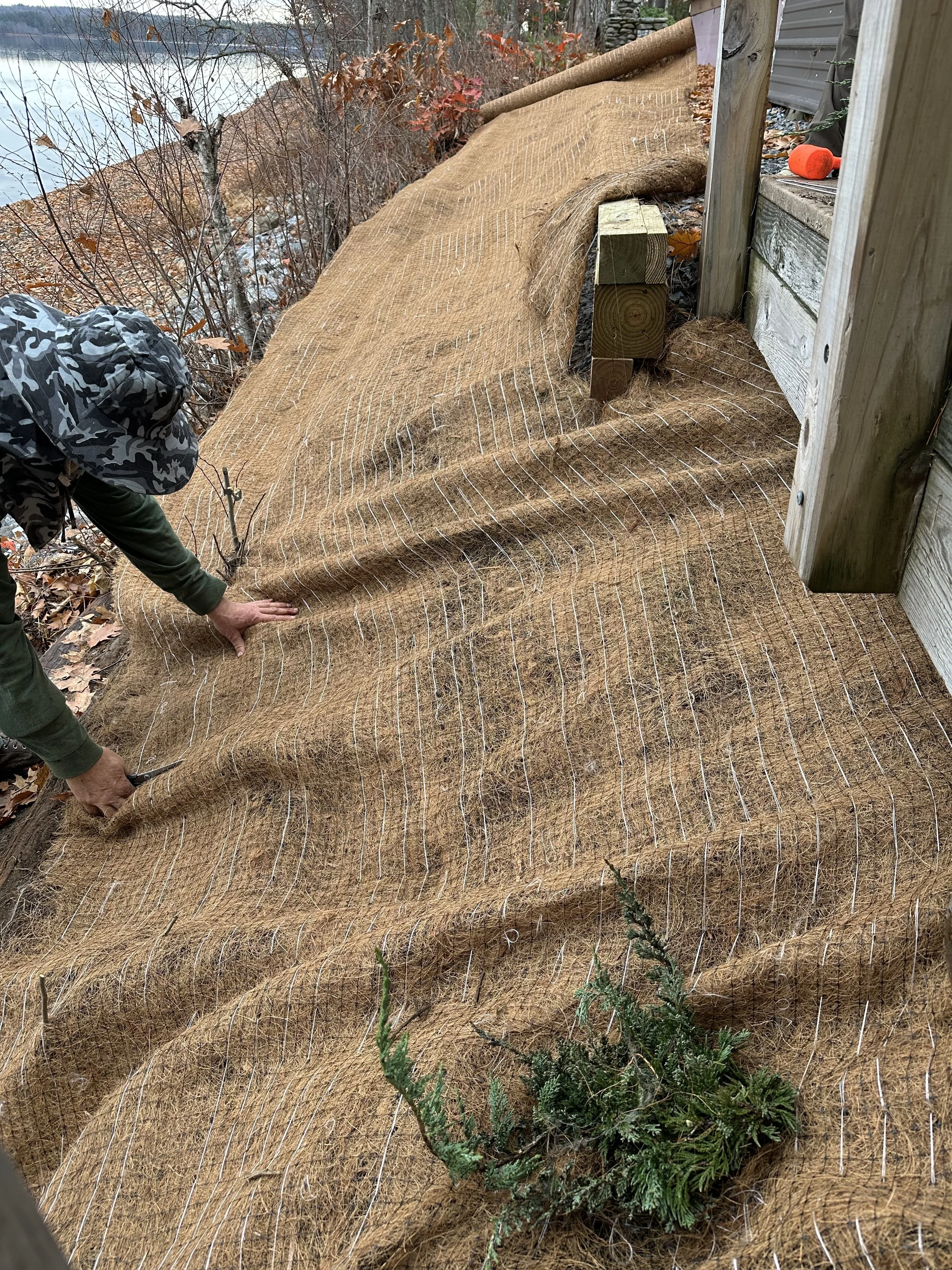
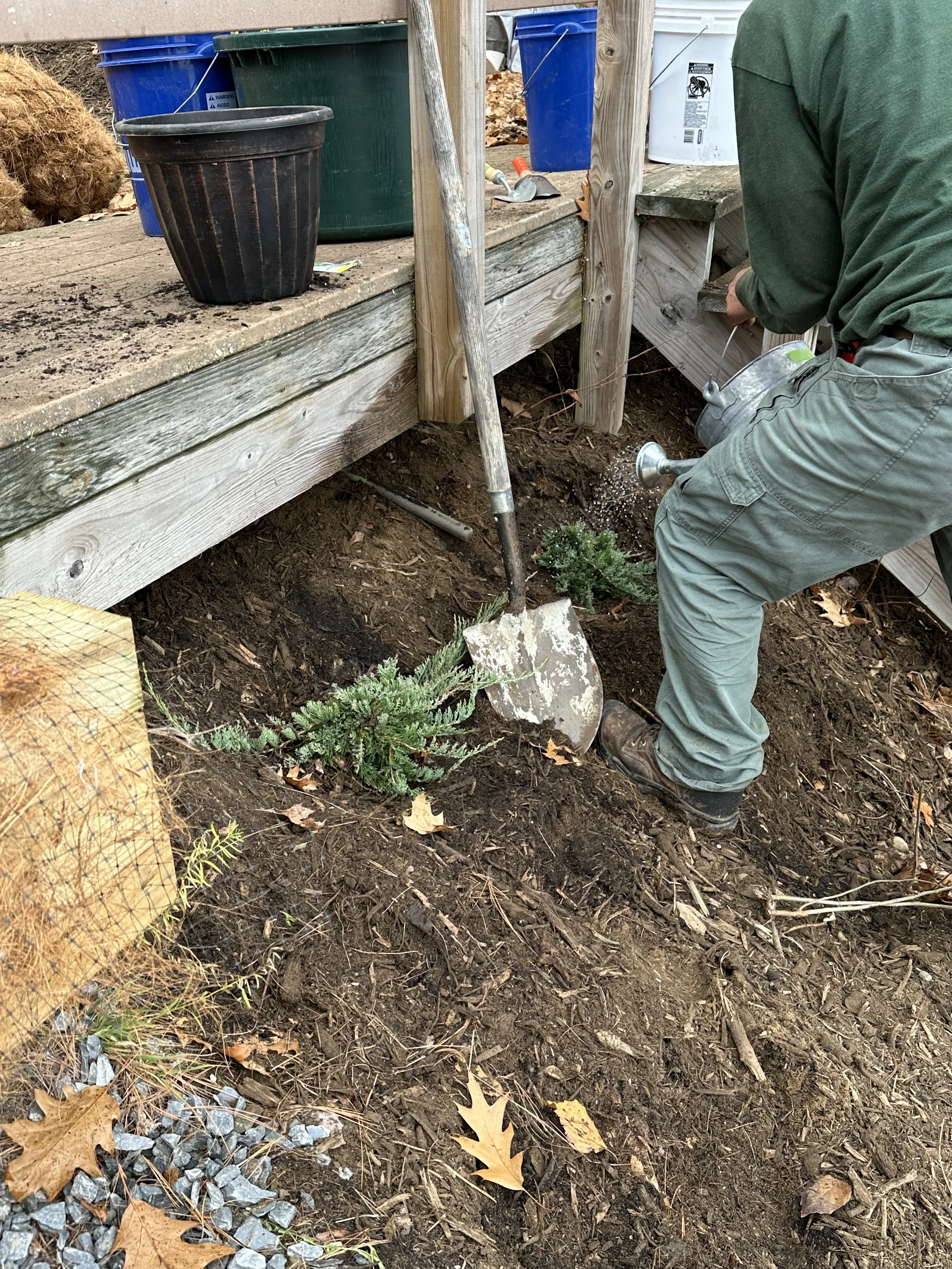
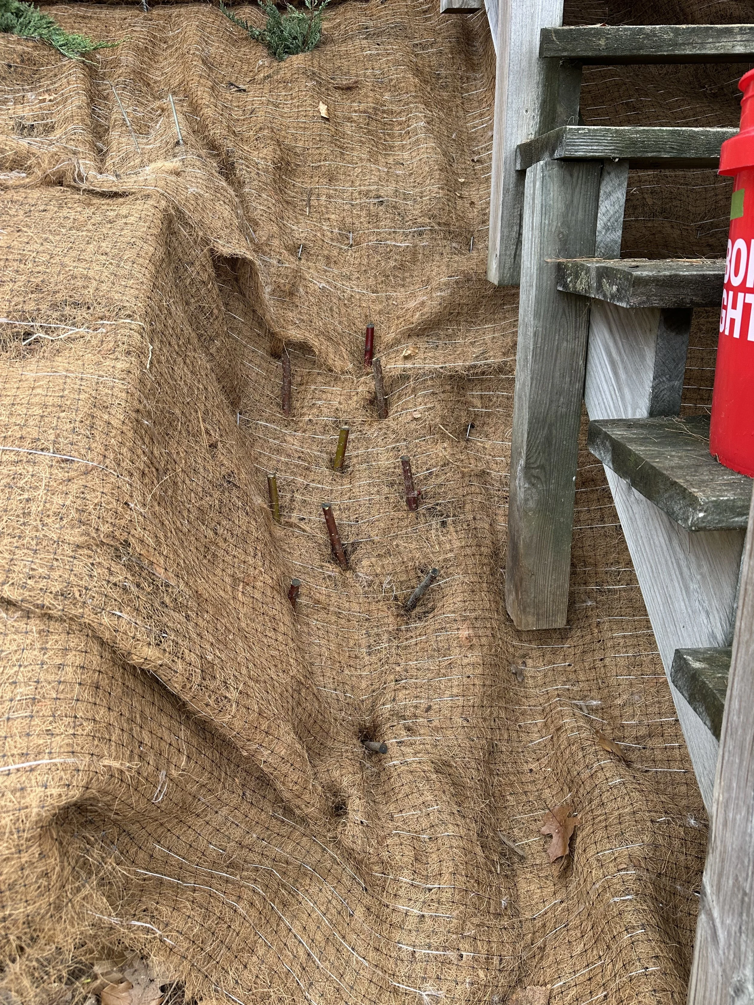
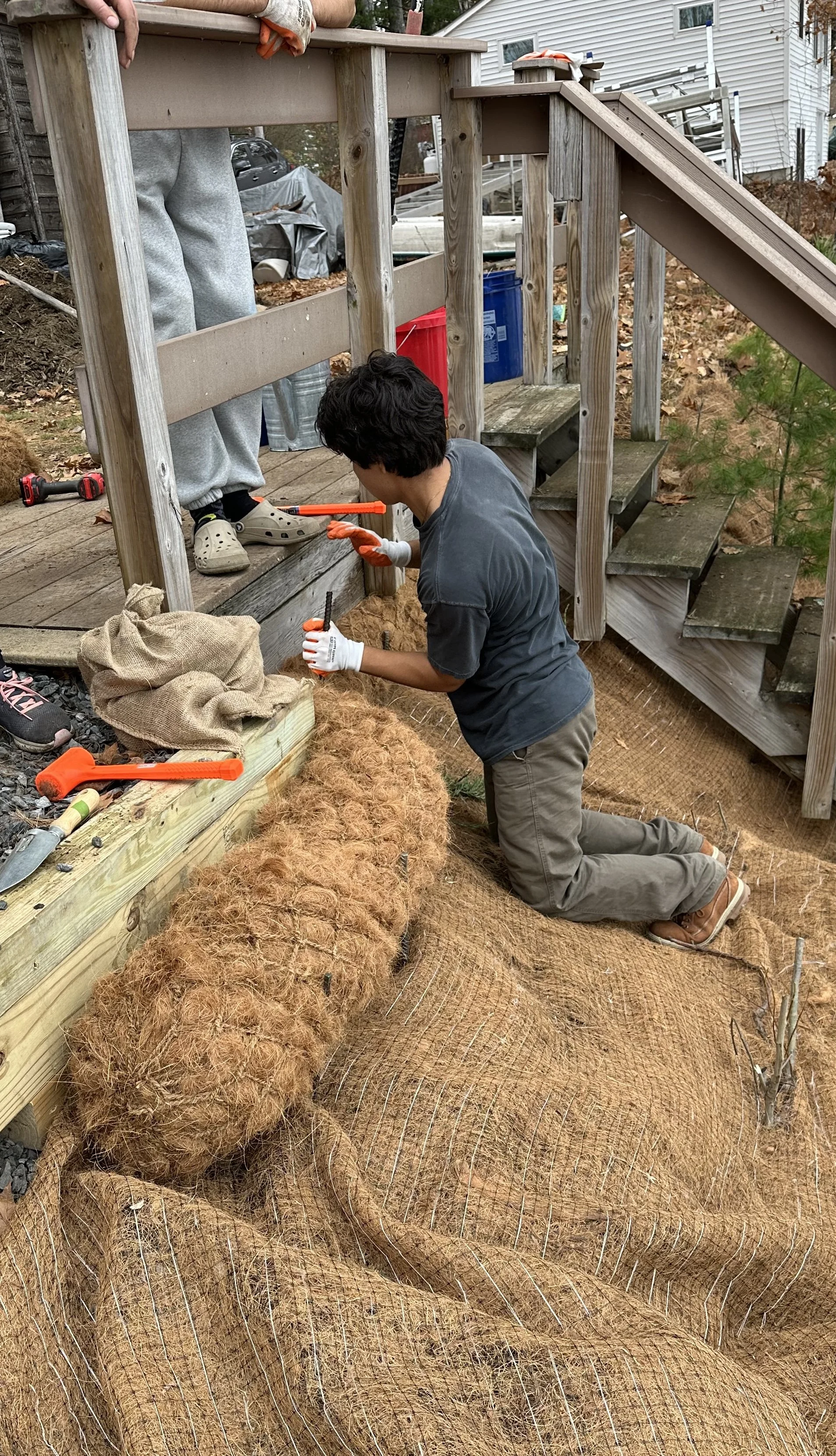
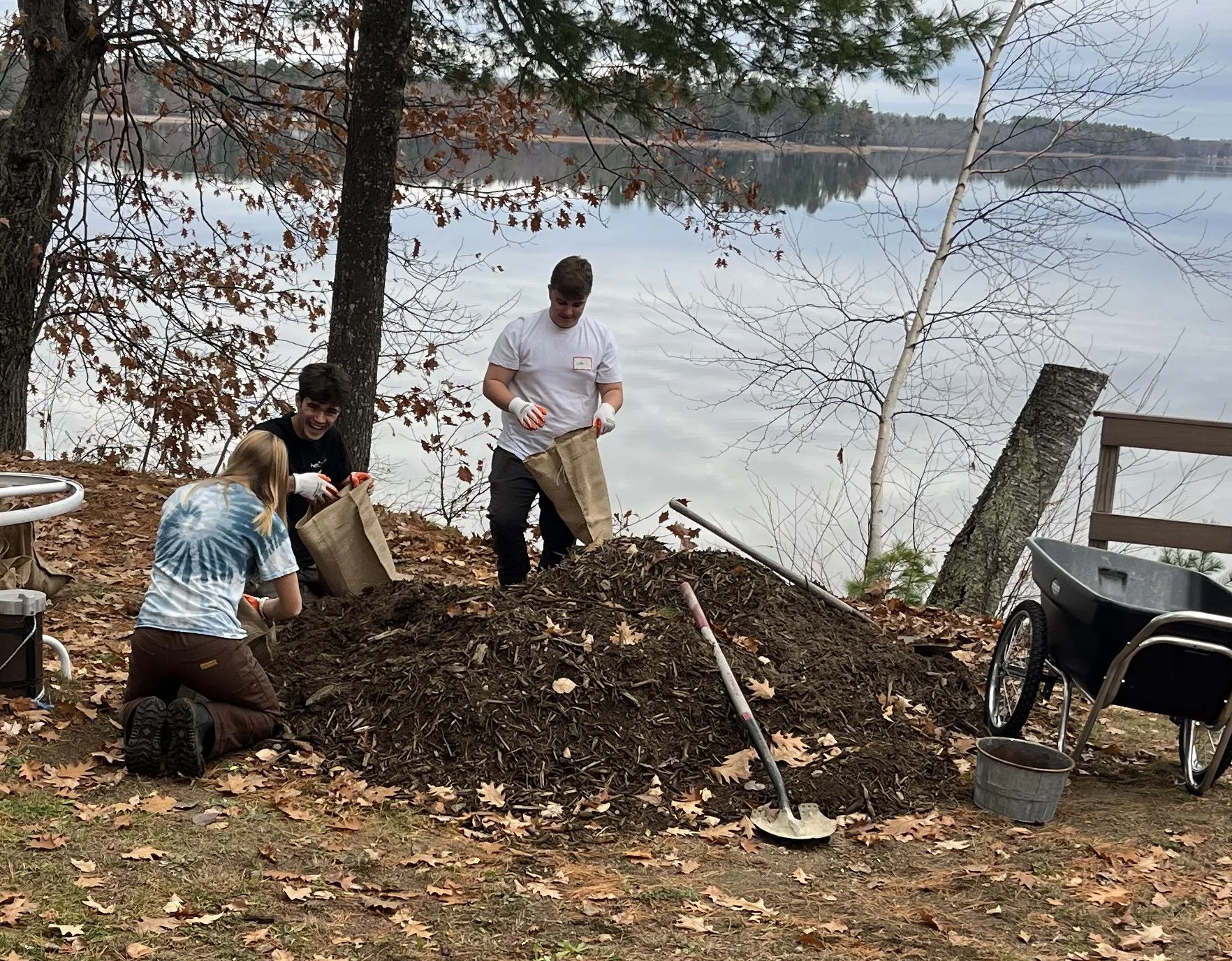
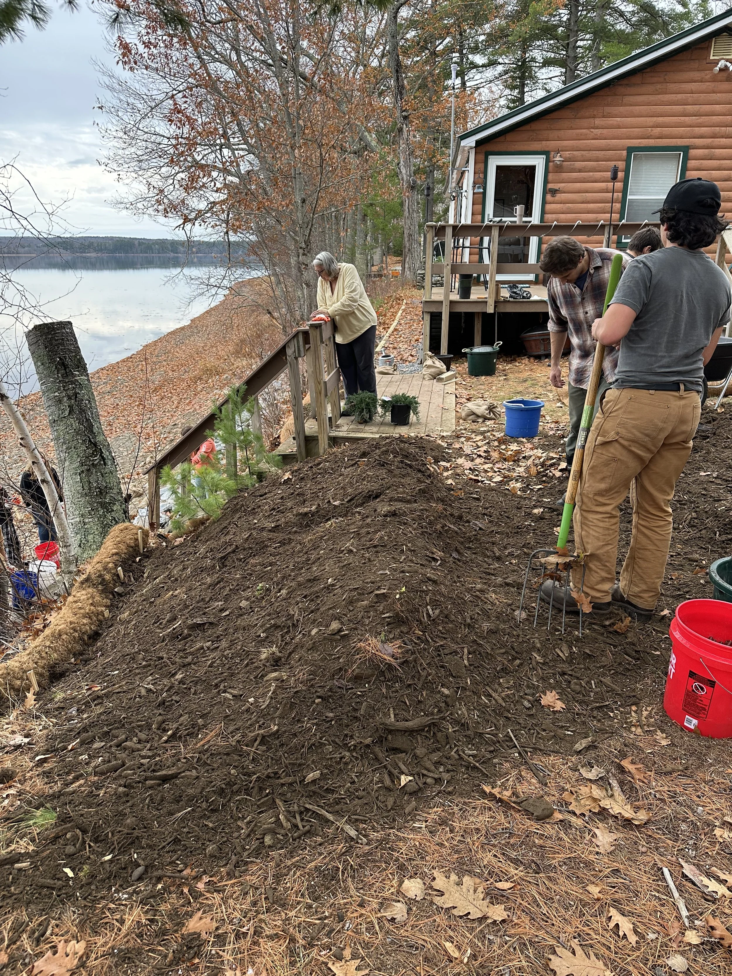
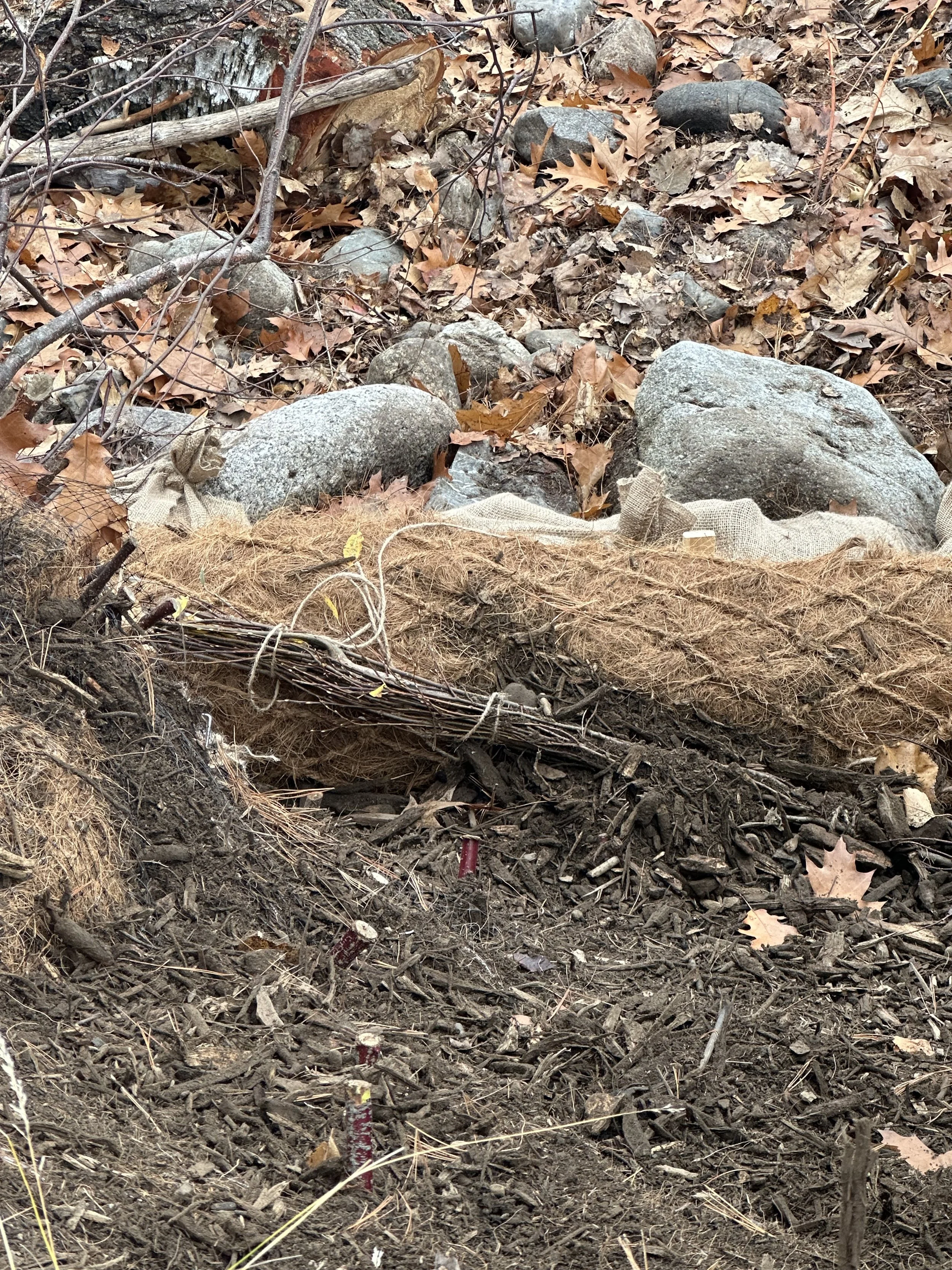
Many of these work as a team. Coir logs and sacks hold the toe of the bank against waves, blankets and mulch protect the face of the slope, and the stakes, fascines, and plantings gradually take over the job as their roots grow.
A shoreline that grows stronger
The payoff comes over the next few seasons, as stakes leaf out, fascines root in, and juniper spreads across the slope. Unlike a wall, which starts aging the day it's built, a living shoreline gets stronger with time.
The two Barak Point Lane sites are now a working example for anyone on Unity Pond wondering what to do about their own eroding bank. The techniques are practical, the materials are mostly natural, and many can be adapted by homeowners with guidance from the organizations involved in this work.
If you live on the lake and are noticing bare soil, exposed roots, or runoff channels heading toward the water, reach out to the District or the Friends of Lake Winnecook. Every stabilized shoreline is one less source of phosphorus, and one more step toward clearer water for everyone.
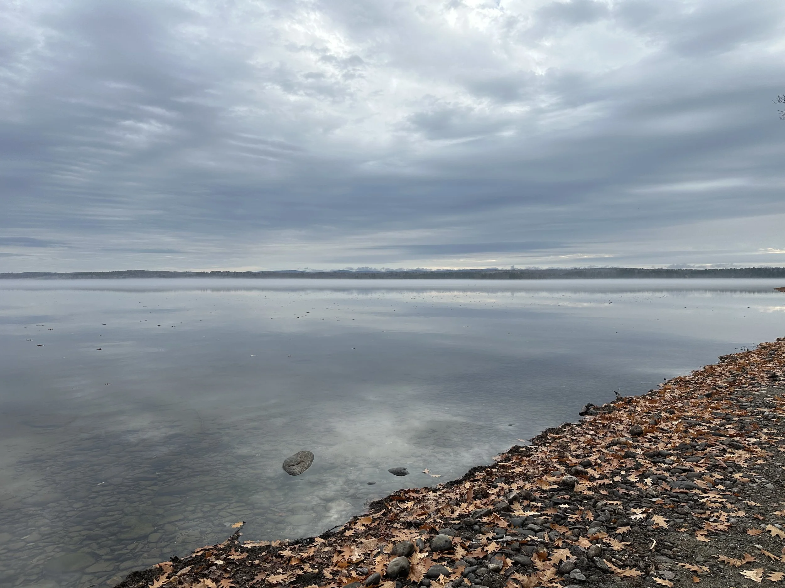
Unity Pond on the day of the workshop, November 6, 2026.
Photo: Sarah Whateley, Waldo County SWCD
The people behind the project
This work was a true partnership. Thank you to:
Patti Sizemore and Robert Garabedian, homeowners, for opening their shoreline to the project
Jen Jesperson and the team at EcoInstincts, who designed the shoreline stabilization plans
Valerie Watson, Maine Department of Environmental Protection, who visited to approve the plan modifications each site needed
Kate Coseo and her students at the Ecology Learning Center
Jordan Kimball, Maine Department of Environmental Protection, Nonpoint Source Pollution Training Center
Parker Gassett, Assistant Director, Maine Climate Science Information Exchange, University of Maine
Mary Ann Hayes, Friends of Lake Winnecook
Sarah Whateley and Cassidy Gerrish, Waldo County Soil and Water Conservation District
Funding for this project, in part, was provided by the U.S. Environmental Protection Agency under Section 319 of the Clean Water Act. The funding is administered by the Maine Department of Environmental Protection in partnership with EPA. EPA does not endorse any commercial products or services mentioned.
